Southwest Avery Plaza
Follow Us On Facebook

 Vision 2025 Route 66 Enhancements and Promotion
- Determine what is to be placed at the Southwest Avery Plaza on ODOT land
- Budget: $500,000
Background
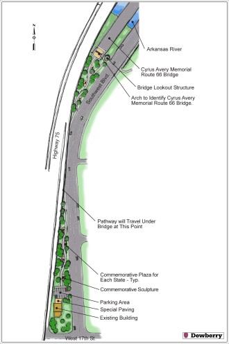
A kick-off public meeting was held on January 24, 2017 for one of the remaining Vision 2025 Route 66 Master Plan projects to be implemented. Avery Plaza Southwest is the west approach to the historic Route 66 Bridge, which is on the National Register of Historic Places. The site combines with a segment of Route 66 that includes the restored Cities Service Gas Station, Avery Centennial Plaza and Skywalk, the East Meets West Sculpture and the future Route 66 Experience interpretive center. The budget is $500,000 and is all inclusive of design and construction. Improvements by the Oklahoma Department of Transportation (ODOT) to I-244 east and west bound bridges had to be completed before this project began design.
The event was hosted by the City of Tulsa and moderated by two Route 66 Commission’s Design & Preservation Committee members representing Whittier Square Main Street and the Tulsa Foundation for Architecture. Engineering consultants, Dewberry, and landscape architecture consultants, Howell Vancuren, provided background Master Plan and site information. Refreshments were provided by the Route 66 Alliance and the meeting space was provided by Cyntergy. Approximately 50 attendees engaged in 90 minutes of presentation and discussion which resulted in a list of new ideas.
The original Master Plan concept was characterized by a space to view the Art Deco architecture of the historic bridge. The original concept included the possibility of parking on a small piece of privately owned land. Subsequent design of the I-224 Bridge included a pedestrian walkway the length of the I-244 eastbound bridge and a special Route 66 thematic viewing area with seating, plaques and signage extending several hundred feet from the east bank of the river. In addition, ODOT extended the River Trials underneath the historic bridge providing close viewing and superseding the original features of the original concept.
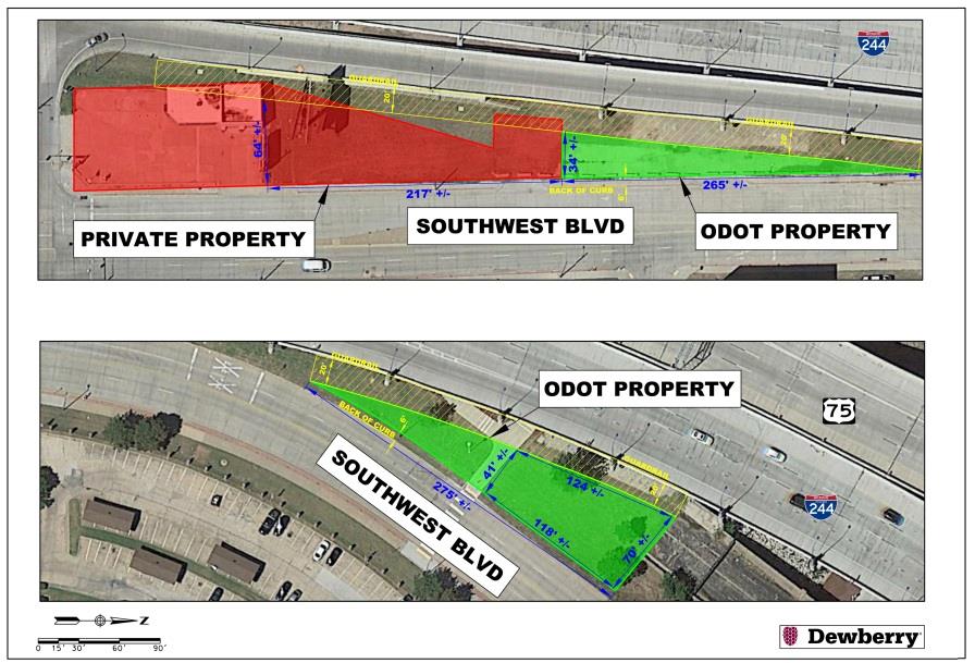
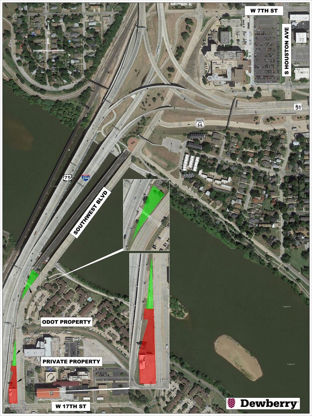
The area of primary focus for a revised concept (below right) is approximately 41’ x 124’ x 70’ x 118’ and abuts the historic bridge. The potential to include other private or ODOT property in the final design is under review. The site is well connected to the River Trails system with trails circulating around the site and extending along both banks of the river.
Constraints to developing the site include: a lack of direct parking, an ODOT maintenance zone 20 feet from the edge of the overhead I-244 structure, nearby railroad tracks and traffic speeds.
The Route 66 Commission’s Design & Preservation Committee along with city staff will develop public comments into potential concept themes for final public comment.